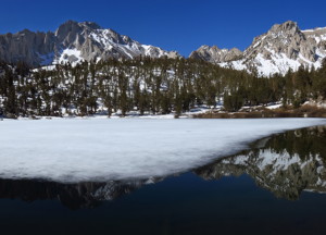
Forecast: Owens Valley, Mammoth and Mono County
By: Dennis Mattinson, Weather & Atmospheric Forecaster

SierraWave Media: Radio – TV – Online News
MON MAY 06 2013
The low that brought us winds and clouds yesterday (a little rain here and there) is now centered west of Monterey Bay this morning. It will bring weather to our area, the next few days, in the form of isolated thunderstorms, gusty winds, maybe some rain and snow in the upper elevations. Of course this forecast is a bit tricky because some of this weather could develop just about anytime, anywhere in our district. As this system hits the coast, it will pickup some sub-tropical moisture. So today and Tuesday look to be the best days for any wide spread precipitation. It begins to meander east Wednesday and Thursday and is replaced by a ridge of high pressure Friday.
For the Owens Valley:
Today: 50% chance of scattered rain and isolated thunderstorms. Highs 64 – 67 / Lows 46 – 49. Winds S 15 – 25 mph.
Tuesday: 50% chance of scattered rain and thunderstorms. Highs 63 – 66 / Lows 50. Winds SE 5 – 15 mph.
For the Town of Mammoth Lakes:
Today: 80% chance of rain or snow showers. Highs 48 / Lows 33. Winds S 10 – 15 mph.
Tuesday: 80% chance of rain and snow showers. Highs 45 / Lows 34. Winds W 5 – 10 mph.
For Mono County:
Today: Showers and scattered thunderstorms. Highs 52 – 62 / Lows 32 – 42. Winds SE 5 – 15 mph.
Tuesday: Scattered showers and isolated thunderstorms. Highs 49 – 59 / Lows 32 – 42. Winds NW 10 mph.